World Map <mv-world-map>
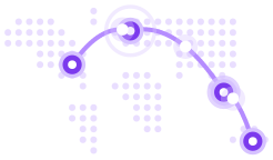
Mapa-múndi SVG pontilhado construído com dados de terras de domínio público do Natural Earth, com rotas ortodrômicas reais que se desenham e levam pequenos pacotes, sinalizadores nas cidades-polo, rótulos HTML nítidos e uma lista para leitores de tela com cada lugar e cada conexão.
| Categoria | Mídia |
|---|---|
| Tipo | Web Component (<mv-world-map>) |
| Status | estável |
| Keywords | map, world, dotted-map, arcs, routes, great-circle, markers, svg, connections, hero |
When to use
- Global presence, offices or customers must be shown as markers on a flat dotted map
- Shipping lanes, flights or data links between cities should read as real routes with flowing packets
- A wide hero or about section needs every location visible at once without 3D interaction
Avoid when
- A rotating, draggable 3D earth is wanted as a centerpiece → use Globe instead
- Precise geography, zoom, panning or many data points are needed; use a dedicated mapping library
Instalação
node scripts/add.mjs world-map --out ./src/marvelousAgente de IA com o servidor MCP do Marvelous UI: install_components({ slugs: ["world-map"], target_dir: "<absolute path>/src/marvelous", framework: "react" }).
Arquivos copiados (dependências incluídas): tokens/tokens.css, core/base.css, core/dom.js, core/element.js, core/i18n.js, core/observe.js, components/world-map/world-map.js, components/world-map/world-map-land.js, components/world-map/world-map.css.
Uso
Marcação de referência, para usar como ponto de partida e personalizar com atributos, data-* e variáveis CSS:
<div style="display:grid;gap:1.25rem;width:100%;max-width:64rem;margin-inline:auto">
  <header style="display:flex;flex-wrap:wrap;align-items:end;justify-content:space-between;gap:1rem">
    <div>
      <p style="margin:0 0 .4rem;font:600 .75rem/1 var(--mv-font-mono);letter-spacing:.12em;text-transform:uppercase;color:var(--mv-accent-fg)">Shipments in transit</p>
      <h3 style="margin:0;font:700 clamp(1.3rem,2.4vw,1.75rem)/1.15 var(--mv-font-sans);letter-spacing:-.02em">Nine warehouses, one network</h3>
    </div>
    <p style="margin:0;font-size:.85rem;color:var(--mv-fg-muted)">1,248 packages · 3.4-day average transit · hover a city</p>
  </header>
  <mv-world-map label="Shipping lanes between our warehouses" labels
    markers="51.51,-0.13,London; 40.71,-74.01,New York; -23.55,-46.63,São Paulo; 14.72,-17.47,Dakar; 25.2,55.27,Dubai; 1.35,103.82,Singapore; 35.68,139.69,Tokyo; 34.05,-118.24,Los Angeles; -33.87,151.21,Sydney"
    arcs="London>New York; London>São Paulo; London>Dakar; London>Dubai; Dubai>Singapore; Singapore>Sydney; Singapore>Tokyo; Tokyo>Los Angeles; Los Angeles>New York"></mv-world-map>
</div>
API
Attributes
| Name | Tipo | Padrão | Descrição |
|---|---|---|---|
markers | string | “lat,lng,Label; …” (label optional). The property also accepts [{ lat, lng, label }]. | |
arcs | string | Routes: “0>1; Paris>Dakar” (indexes or labels) or hub (first to all), chain (one after another), all. The property accepts [[from, to], …]. | |
labels | boolean | Shows marker labels as small HTML chips (otherwise a native tooltip on hover). | |
columns | number | 160 | Number of dot columns (40-400): grid density. |
stagger | boolean | Offsets every other row by half a cell (hexagonal grid). | |
duration | number | 3.2 | Seconds a packet takes to travel a route from end to end. |
label | string | World map | Accessible name of the figure. |
Properties
| Name | Tipo | Descrição |
|---|---|---|
markers / arcs | Array | Read: parsed values; write: array or string. |
strings | object | Overrides the screen-reader text: map, places, routes, route (“{from} to {to}, {distance}”). |
Methods
| Name | Descrição |
|---|---|
project(lat, lng) | [x, y] coordinates in the viewBox (to overlay your own SVG elements). |
CSS classes
| Name | Descrição |
|---|---|
mv-world-map-dots / -arc / -line / -comet / -marker / -ping / -label | Generated parts (stylable): -line is the route, -comet its traveling packets, -ping the beacon. |
CSS variables
| Name | Padrão | Descrição |
|---|---|---|
--mv-world-map-dot | fg 24% | Dot color. |
--mv-world-map-dot-size | 0.5 | Dot diameter, as a fraction of the cell. |
--mv-world-map-arc | var(--mv-accent) | Route and packet color. |
--mv-world-map-marker | var(--mv-accent) | Marker and beacon color. |
--mv-world-map-label | var(--mv-fg) | Label color. |
Accessibility
role=figure named by label; the SVG and the label chips are aria-hidden, and a visually hidden list gives every location and every connection with its great-circle distance (strings are overridable). Hovering a city highlights its routes. On a small map, a label that would overlap another label or pin moves to the other side of its pin, or gives way when neither side is free (the place stays in the pin tooltip and in the screen-reader list). Reduced motion: routes drawn at once, no packets and no beacons. Forced colors: system colors for dots, routes, pins and labels.